Services

Advanced Drone Services for Inspection, Surveys & Aerial Intelligence.

Our Professional Drone Service Solutions

Sunsky Drones delivers cutting-edge drone-based solutions for industries that demand accuracy, safety, and efficiency. Our professional UAV services help organizations capture critical aerial data, reduce operational risks, and make smarter decisions using advanced drone technology.

Transmission Line Inspection

Drone-based inspections identify faults, hotspots, and structural issues in transmission lines, improving safety & reducing downtime.

Solar Panel Inspection

Thermal drone surveys detect faulty panels, hotspots, and efficiency losses, helps optimize energy output and reduce maintenance costs.

Lidar Inspection

High-precision LiDAR mapping generates accurate 3D terrain and asset models, enabling better planning, analysis, and decision-making.

Windmill Inspection

Drones inspect turbine blades and structures to detect cracks, erosion, and damage, extending asset life and minimizing downtime.

Railway Asset Inspection

Aerial inspections assess tracks, bridges, and railway infrastructure efficiently, enhancing safety and reducing service disruptions.

Bridge Inspection

Drone inspections identify structural defects without traffic blockage, ensuring public safety while lowering inspection time and costs.

Powerplant & Chimney Survey

Drones assess chimneys and power plant structures for cracks, corrosion, and defects without shutdowns or risky manual access.

Land & City Aerial Mapping

High-resolution aerial mapping supports urban planning, land assessment, and infrastructure development with accurate geospatial data.

Forest Survey & Animal Rescue

Drone surveys help monitor forest areas, locate endangered animals, and support faster, safer rescue operations.

Highways Aerial Surveys

Drone mapping supports highway planning, monitoring, and expansion projects with fast, accurate route and condition analysis.

Crowd Surveillance

Monitoring improves crowd management, event safety, and emergency response through real-time situational awareness.

Railway Track OHE Inspection

Drone inspects long railway corridors significantly faster than conventional methods. Detects wire wear, sag, misalignment, and all.

Wedding & Event Coverage

Cinematic aerial photography and videography capture stunning perspectives for weddings, events, and special occasions.

Agricultural Survey

Drone data helps monitor crop health, soil conditions, and irrigation patterns to improve yield and farming efficiency.

Drone Show & Advertisement

Custom drone shows and aerial advertising deliver innovative, high-impact visual experiences for branding and promotions.

Completed Drone Projects
0 +
Industry & Enterprise Clients
0 +
Project Accuracy & Timely Delivery
0 %

Why Partner with Sunsky Drones?

At Sunsky Drones, we combine advanced drone technology, certified pilots, and data-driven workflows to deliver reliable aerial solutions for critical industries.

Precision-Driven Aerial Data

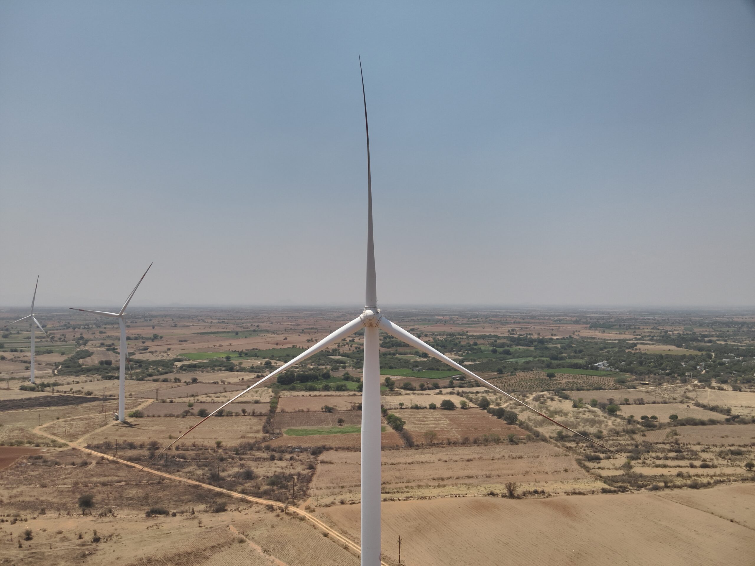
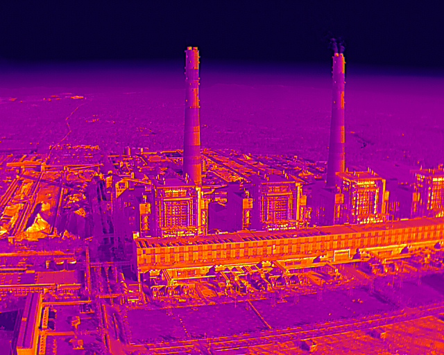
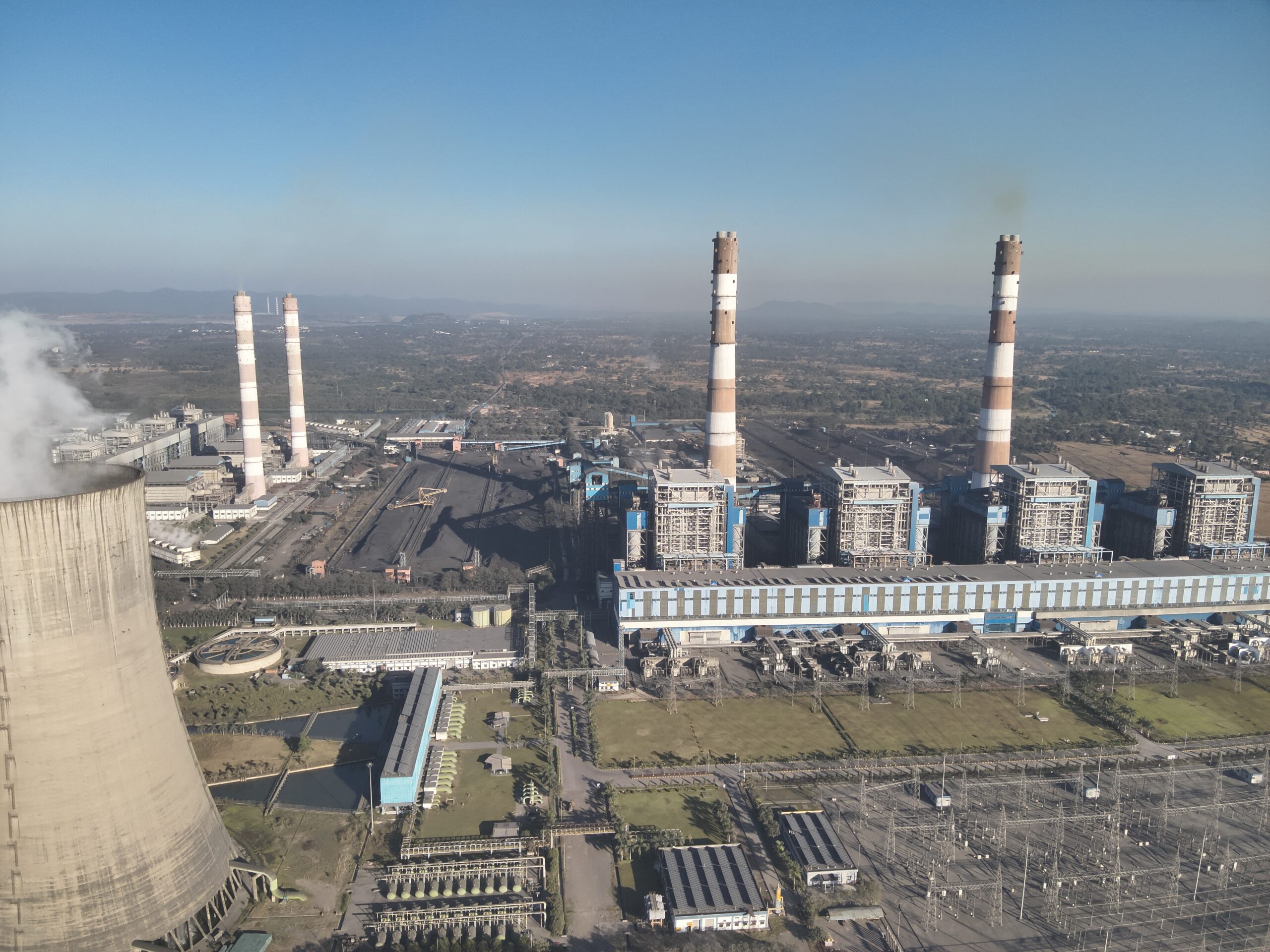
We capture high-resolution RGB, thermal, and LiDAR data with exceptional accuracy, ensuring reliable results for inspections, surveys, and mappings.

01

Safer Than Traditional Methods

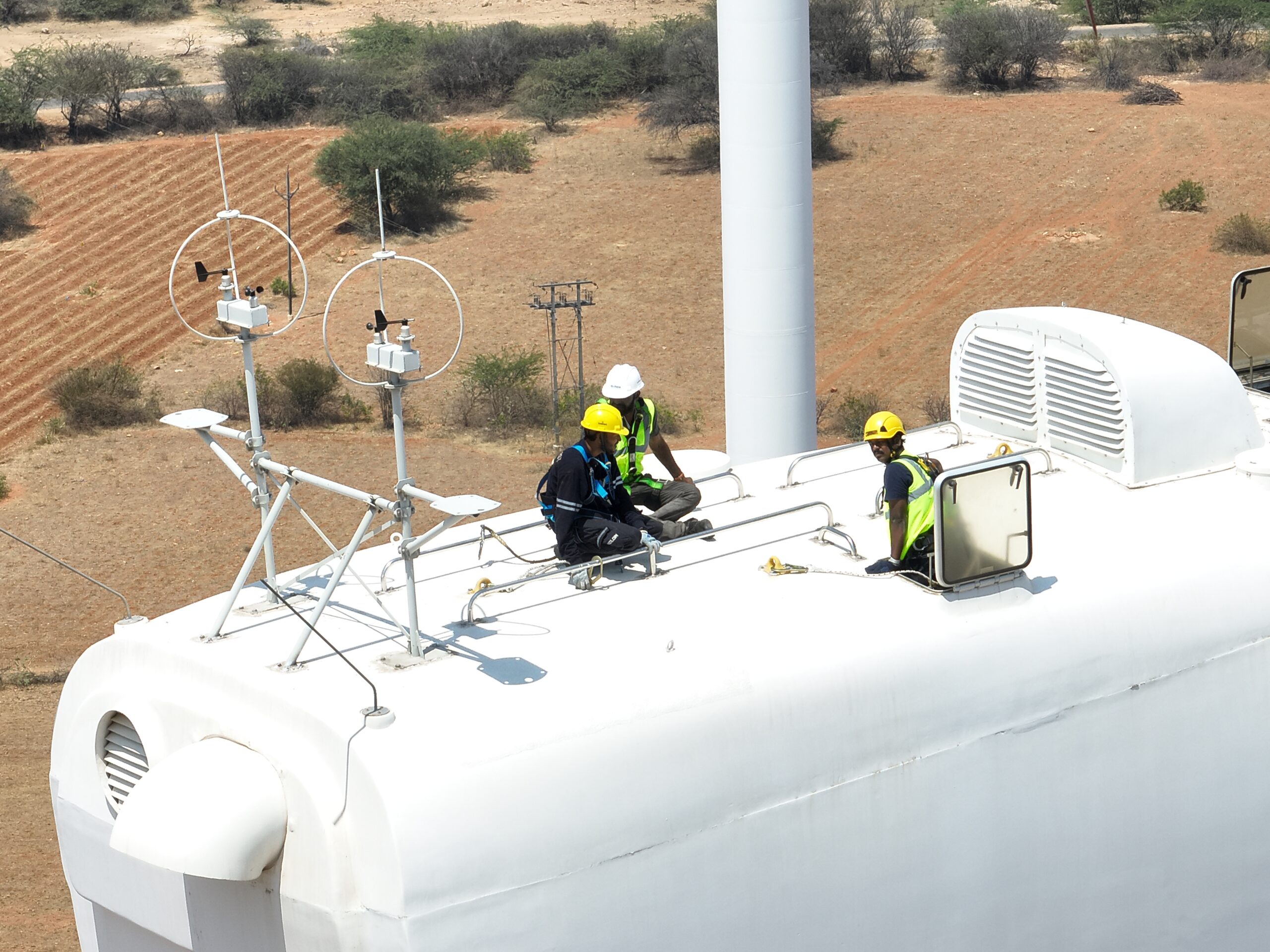
Our drone inspections eliminate the need for scaffolding, rope access, or shutdowns—reducing human risk while maintaining operational continuity.

02

Faster Project Turnaround

Drone-based data collection significantly reduces survey and inspection time, helping projects move faster without compromising data quality.

03

Industry-Ready Expertise

From infrastructure and energy to agriculture and urban planning, our team understands industry-specific challenges and delivers custom drone solutions.

04

How Our Drone Services Work

We follow a structured, technology-driven workflow to deliver accurate, safe, and efficient drone inspection and survey services.

01

Project Requirement & Planning

We understand your project objectives, site conditions, and compliance needs to design a customized drone inspection plan.

02

Drone Deployment & Data Capture

Our certified pilots deploy advanced drones equipped with  sensors to collect high-quality aerial data safely and efficiently.

03

Data Processing & Analysis

Captured data is processed using professional software to generate accurate insights, 3D models, reports, or geospatial maps.

04

Reporting & Actionable Insights

We deliver clear, industry-ready reports and visuals that support decision-making, maintenance planning, and project execution.

Bringing Advanced Drone Services Closer to You

From urban inspections to remote site surveys, our drone operations deliver accuracy, speed, and safety—wherever your project is located.

Book Your Appointment

Schedule a consultation with our drone experts to understand how Sunsky Drones can support your inspection, survey, or aerial mapping needs. Whether you require infrastructure inspections, land mapping, agricultural analysis, or specialized drone operations, our team will guide you with the right technology and approach.

We focus on regulatory compliance, project safety, and actionable insights, ensuring you receive results that matter—not just aerial visuals.

Beyond Roads, Into Skies

Stay Updated with Sunsky Drones

Get the latest news, updates, and special offers.

Company

Services

Contact Info